
 Mappetizer Web Mapping Software
|
Mappetizer Web Mapping Software OnlineGIS - no servers, no hassle, no plug-in Ready to go within a few minutes! HTML5 Maps | GPS Visualization ©2002-2019 |
Publish your GIS data in the Web» Vector based maps with high quality » Interactive Web maps with many features » Easy to use, fast results » No additional software on the Web server needed Examples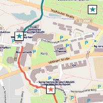 |
Software | Logiciel | Computer program | Szoftver | Application | Computerprogramma | Softvér |
|
We are proud to present a new release of Mappetizer for ArcGIS.
Many new demo maps can be find here.
A list of new features be seen here.
The Statistikamt Nord use Mappetizer for ArcGIS to present the election data on maps.
CPRE presents interactive maps of England’s light pollution and dark skies.
The Thüringer Klimaargentur shows a new map Convective storms potential.
The NGO MapAction has used Mappetizer for ArcGIS during the response to Nepal earthquakes to create village level maps describing agency presence and activities. The maps are used both online and offline, which are vital to ensure seemless coordination.