 Mappetizer Web Mapping Software
 Services
uismedia will offer services around web mapping. We useour software products Mappetizer and Mappetizer for ArcGIS and also other API's:
- You are working with our products Mappetizer and Mappetizer for ArcGIS and you are missing some functionalities? We will gladly accommodate your individual requests and develop our software further.
- You have exported your project with Mappetizer and you want to add additional functionalities to your Web map project? We enhance your Web map project with additional scripting.
- You do not have ArcGIS but you want to publish your spatial as a webmap? We will edit your spatial data and export them with Mappetizer.
- You have your own ideas and requests but want to publish your spatial data? No problem!
Examples
- Implementation of a slider to visualize time series
- Implementation of animations
- Tracking functionalities
- Example: Display of time based layers - real time or fast motion
- Developing of enhanced database functionalities (geometry and attribute data)
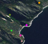
- Example: Restaurant Guide Freising
Web mapping solutions with Open Source Software
Furthermore we offer services within:
- Web mapping solutions with Open Source Software (MapServer or MySQL Spatial).
- Web mapping applications provided by Google Maps Api.
References
- Bayerisches Landesamt für Umwelt, Augsburg, Germany
- BügelHajema Adviseurs, Assen, Netherlands
- Fachhochschule Nürtingen, Nürtingen, Germany
- Airport Zürich AG, Zürich, Switzerland
- Georgia Department of Transportation, Georgia, USA
- Land Use Consultants, Glasgow, Scotland
- MIA consulting, Idaho Falls, USA
in addition:
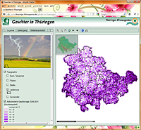
Thunderstorms in ThüringenOur service: Expanding our software by slider functionalities. |
 |
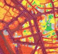
SVG based output in CadnaA, software for noise calculation, noise prediction, and noise mappingClient: DataKustik GmbH, Greifenberg |
 |
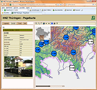
Hochwassernachrichtenzentrale ThüringenOur service: Dynamically adjustment of symbols and attributes. |
 |
Cape Town Early Detection and Rapid Response (EDRR)Our service: Database driven map to show current sights of specific (invasive) plants. |
 |
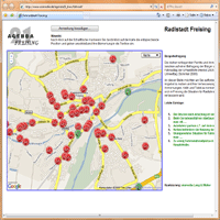
Radlstadt FreisingOur service: Developing and programming of a map based application based on Google Maps Api. |
|